


no info
🕗 opening times
| Monday | ⚠ | |||||
| Tuesday | ⚠ | |||||
| Wednesday | ⚠ | |||||
| Thursday | ⚠ | |||||
| Friday | ⚠ | |||||
| Saturday | ⚠ | |||||
| Sunday | ⚠ | |||||
59/10, VIP Road, Agra, Uttar Pradesh 282001, India
contacts phone: +91 562 240 0844
website: www.aai.aero
larger map & directionsLatitude: 27.152696, Longitude: 77.9617558

Abdul Gani
::Since while political parties playing with it, since while it's not declared as an international airport. Shame on state and central government, after coming in power, just change the name Agra airport to Pandit Deen dayal upadhaya airport, shameful. Whenever we have to reached Agra, first land at Delhi then travel for 3 hrs, horrible.
obaed ulla
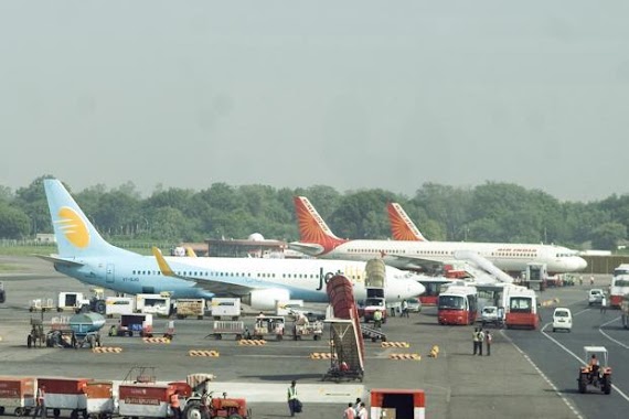
::Pandit Deen Dayal Upadhyay Airport (IATA: AGR, ICAO: VIAG) is a military airbase and public airport serving the city of Agra, in the state of Uttar Pradesh, India. The air force station is one of the largest airbase of the Indian Air Force (IAF) and has been synonymous with the Taj Mahal for over half a century.
war zone
::I went to Agra on 2008 from new zealand I use taxi from dehli to Agra it was good .
nitin singh
::This is small airport. It is not commercially used these days. It is used for VIPs who visit to Agra.
Gurbir Bhatia
::Just by naming it on some patriot, it's not all that is required. The state need to look after the maintenance of this world famous wonder. Pathetic situation.