School nearby Billion Hands Technology
India
School nearby Billion Hands Technology
Billion Hands Technology
1170, Kushabhau Jejurikar Road, Revenue Colony, Shivajinagar, Pune India
contacts phone
:
+91
Latitude:
18.527076
, Longitude:
73.848552
read more
nearest School
466 m
Naveen Marathi School
Shard Salunkhe & Associates, Shivajinagar, Pune
School
read more
493 m
Matimand Vidyalaya
School No:14, Opp. Indian Drugs Association, Congress House Road, Shivajinagar, Pune
School
read more
498 m
Lal Bhadur Shastri School
Cavthan, Pune
School
read more
699 m
ACE Engineering Academy
24/4, Opp. Patel Tiles, Behind Shivaji Nagar Bus Stand, Rambhau K Kamble Path, Further Down Hotel Pride, Narveer Tanaji Wadi, Shivaji Nagar, Pune
School
read more
893 m
Layashala Kathak Dance Classes
297,, Shaniwar Peth, Pune
School
read more
919 m
Andhra High School
Shivajinagar
School
read more
1.132 km
Laxmi International School
Sarigam, Laxmi Vidyapeeth P.B.No. 15, Sarigam Post-Valsad, Teh-Umargam Dist-Valsad, Gujarat, Valsad
School
read more
1.133 km
Orchid school
NIBM Road, Dattwadi, Shobhapur, Kasba Peth, Pune
School
read more
1.133 km
Western Academy
1, Swojas Excellency, Ganeshwadi, Behind Oriental Bank of Commerce,, Opp Roopali Hotel, F C Road,, Deccan, Pune
School
read more
1.137 km
Samajkalyan Hostel Vishrantwadi
Mental Corner Vishantwadi, Pune
School
read more
1.137 km
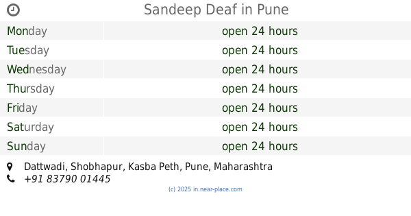
Sandeep Deaf
Dattwadi, Shobhapur, Kasba Peth, Pune
School
read more
1.137 km
Sardar Dastur Boys School
Ratapur Road, Pune
School
read more
1.137 km
Sent Pual School
Dattwadi, Shobhapur, Kasba Peth, Pune
School
read more
1.137 km
Genius Kids Gurukul Shirur
3131/32 Mumbai Bazaar, Shirur
School
read more
1.14 km
Dayanmitra Academy
16/12, Sudhanshu Uco Bank Colony, Patwardhan Baug, Patwardhan Baug, Shobhapur, Kasba Peth, Pune
School
read more
📑
all categories
Accounting
Administrative area level 1
Administrative area level 2
Airport
Amusement park
Aquarium
Art gallery
Atm
Bakery
Bank
Bar
Beauty salon
Bicycle store
Book store
Bowling alley
Bus station
Cafe
Campground
Car dealer
Car rental
Car repair
Car wash
Casino
Cemetery
Church
City hall
Clothing store
Colloquial area
Convenience store
Courthouse
Dentist
Department store
Doctor
Electrician
Electronics store
Embassy
Finance
Fire station
Florist
Food
Funeral home
Furniture store
Gas station
General contractor
Grocery or supermarket
Gym
Hair care
Hardware store
Health
Hindu Temple
Home goods store
Hospital
Insurance agency
Intersection
Jewelry store
Laundry
Lawyer
Library
Light rail station
Liquor store
Local government office
Locality
Locksmith
Lodging
Meal delivery
Meal takeaway
Mosque
Movie rental
Movie theater
Moving company
Museum
Natural feature
Neighborhood
Night club
Painter
Park
Parking
Pet store
Pharmacy
Physiotherapist
Place of worship
Plumber
Point of interest
Police
Political
Post office
Premise
Real estate agency
Restaurant
Roofing contractor
Route
Rv park, camping
School
Shoe store
Shopping mall
Spa
Stadium
Storage
Store
Subpremise
Subway station
Supermarket
Synagogue
Taxi stand
Train station
Transit station
Travel agency
University
Veterinary care
Zoo
administrative area level 3
sublocality level 1
sublocality level 2
sublocality level 3
↑