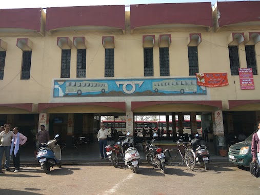
Bus station nearby Civil Lines Bus Station (UPSRCTC), Allahabad
India
Bus station nearby Civil Lines Bus Station (UPSRCTC), Allahabad
Civil Lines Bus Station (UPSRCTC), Allahabad
Madhopur, Allahabad, Uttar Pradesh 211001, India
contacts phone
:
+91
Latitude:
25.4479495
, Longitude:
81.8385893
larger map & directions
read more
nearest Bus station
69 m
Civil Lines Bus Stand (South Gate)
Nawab Yusuf Road, Civil Lines, Allahabad
Bus station
read more
69 m
bus stand civil lines
Patrika Marg, Madhopur, Allahabad
Bus station
read more
103 m
Civil Lines Bus Station
Civil Lines, Allahabad
Bus station
read more
515 m
Hotel Raj Deluxe
3/6 Johnstonganj ; Kamla Nehru Road, Kamla Nehru Road, Johnston Ganj, Allahabad
Bus station
read more
795 m
Patrika Chauraha Bus Stop
Patrika Marg, Civil Lines, Allahabad
Bus station
read more
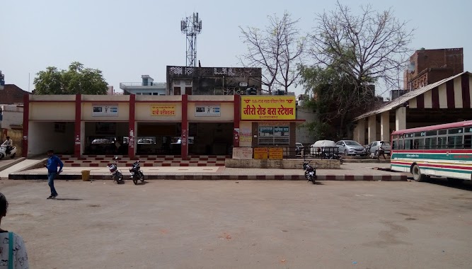
1.033 km
Zero Road Bus Station
Zero Road, Allahabad
Bus station
read more
1.078 km
Zero Road Bus Stand
Zero Road, Mohatsim Ganj, Allahabad
Bus station
read more
1.526 km
Leader Road Bus Stand
Miurabad, Allahabad
Bus station
read more
2.168 km
Pani Tanki Bus Stop
Purushottam Das Tandon Marg, Canton, Dhoomanganj, Allahabad
Bus station
read more
2.829 km
University Road Bus Stop
National HIghway 96, Allahabad University, Old Katra, Allahabad
Bus station
read more
3.028 km
नेता चौराहा बस स्टॉप
New Sohabatia Bagh, Allahpur, Allahabad
Bus station
read more
3.112 km
Patel Churaha Bus Stop
Shiv Nagar, Allahpur, Allahabad
Bus station
read more
3.46 km
Bank Road Bus Stand
National HIghway 96, Old Katra, Allahabad
Bus station
read more
4.237 km
Mazar Chauraha Bus Stop
National HIghway 96, Teliarganj, Allahabad
Bus station
read more
4.489 km
Chakia Bus Taxi Stand
60 Feet Road, Rajrooppur, Daiwghat
Bus station
read more
4.491 km
Daraganj Bus Stop
Adda, Daraganj Ghat Road, Daraganj, Allahabad
Bus station
read more
5.89 km
Govindpur Bus Stand
Govindpur, Teliarganj, Allahabad
Bus station
read more
6.052 km
Cotton Mill Tiraha Bus Stop
National Highway 76, Naini, Allahabad
Bus station
read more
6.7 km
Jhalwa Bus Stop
Shanti Nagar, Devprayagam Colony, Jhalwa, Allahabad
Bus station
read more
8.09 km
Jhunsi Bus Depot
Jhusi
Bus station
read more
8.876 km
Shantipuram Bus Stop
State Highway 9, Sector-E, Shantipuram, Phaphamau
Bus station
read more
9.312 km
Indian Oil Chauraha Bus Stop
Trivenipuram, Jhusi Kohna
Bus station
read more
12.636 km
Tharwai Bus Stop
Tharwai
Bus station
read more
13.776 km
College Bus Stand
Newada Samogar
Bus station
read more
14.709 km
Raymond Gate Bus Stop
Newada Samogar
Bus station
read more
📑
all categories
Accounting
Administrative area level 1
Administrative area level 2
Airport
Amusement park
Aquarium
Art gallery
Atm
Bakery
Bank
Bar
Beauty salon
Bicycle store
Book store
Bowling alley
Bus station
Cafe
Campground
Car dealer
Car rental
Car repair
Car wash
Casino
Cemetery
Church
City hall
Clothing store
Colloquial area
Convenience store
Courthouse
Dentist
Department store
Doctor
Electrician
Electronics store
Embassy
Finance
Fire station
Florist
Food
Funeral home
Furniture store
Gas station
General contractor
Grocery or supermarket
Gym
Hair care
Hardware store
Health
Hindu Temple
Home goods store
Hospital
Insurance agency
Intersection
Jewelry store
Laundry
Lawyer
Library
Light rail station
Liquor store
Local government office
Locality
Locksmith
Lodging
Meal delivery
Meal takeaway
Mosque
Movie rental
Movie theater
Moving company
Museum
Natural feature
Neighborhood
Night club
Painter
Park
Parking
Pet store
Pharmacy
Physiotherapist
Place of worship
Plumber
Point of interest
Police
Political
Post office
Premise
Real estate agency
Restaurant
Roofing contractor
Route
Rv park, camping
School
Shoe store
Shopping mall
Spa
Stadium
Storage
Store
Subpremise
Subway station
Supermarket
Synagogue
Taxi stand
Train station
Transit station
Travel agency
University
Veterinary care
Zoo
administrative area level 3
sublocality level 1
sublocality level 2
sublocality level 3
↑