Hindu Temple nearby Shiv Mandir Khas Sijua
India
Hindu Temple nearby Shiv Mandir Khas Sijua
Shiv Mandir Khas Sijua
Nagri Kalan Indien
contacts phone
:
+91
Latitude:
23.8094643
, Longitude:
86.3301886
read more
nearest Hindu Temple
518 m
Tetulmari Township Hanuman mandir
Tetulmari township, Nagri Kalan
Hindu Temple
read more
580 m
mudidih shiv mandir
Mudidih, tetulmari, Dhanbad
Hindu Temple
read more
663 m
Shiv Mandir Zero Sim
Nagri Kalan
Hindu Temple
read more
692 m
HANUMAN MANDIR
Nagri Kalan
Hindu Temple
read more
768 m
Tetulmari Town Ship, Shiv Shankar Mandir
Nagri Kalan
Hindu Temple
read more
805 m
Hanumangardi Mandir
Nagri Kalan
Hindu Temple
read more
840 m
radha Krishna Mandir Tetulmari
radha krishna mandir tetulmari, Dhanbad
Hindu Temple
read more
855 m
Krishna Mandir
Nagri Kalan
Hindu Temple
read more
885 m
Shiv Mandir
Nagri Kalan
Hindu Temple
read more
898 m
Pandedih Shiv Mandir
Nagri Kalan
Hindu Temple
read more
954 m
Shani dev Mandir Tetulmari
Unnamed Road,, Nagri Kalan
Hindu Temple
read more
994 m
Surya Mandir Chandaur
Nagri Kalan
Hindu Temple
read more
1.23 km
Durga Mandir (Temple)
Nagri Kalan
Hindu Temple
read more
1.449 km
Shiv Mandir,Chhotanagri,828121
Hirak Road, Dhanbad
Hindu Temple
read more
1.555 km
Om Prakash Dharmshala
Nagri Kalan
Hindu Temple
read more
1.639 km
Hanuman Mandir ,Tetulitand
Ganduba
Hindu Temple
read more
1.666 km
Durga Mandir
Kantapahari
Hindu Temple
read more
1.702 km
Hanuman Mandir
Ganduba
Hindu Temple
read more
1.841 km
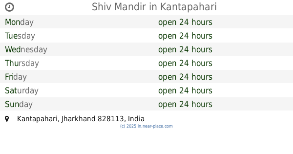
Shiv Mandir
Kantapahari
Hindu Temple
read more
1.972 km
Shiv Mandir (Temple)
Nagri Kalan
Hindu Temple
read more
2.212 km
Shiv Mandir
Dhanbad Chhatabad Road, Katras
Hindu Temple
read more
2.668 km
Kali Mandir
Dhanbad Chhatabad Road, Katras
Hindu Temple
read more
2.689 km
Hanuman Temple
Dhanbad Chhatabad Road, Loyabad
Hindu Temple
read more
2.893 km
Sri Sri Salasar Balaji Mandir
Main Road, Katrasgarh Market, Dhanbad
Hindu Temple
read more
2.91 km
Kalka Sthan
Katrasgarh, Katras
Hindu Temple
read more
📑
all categories
Accounting
Administrative area level 1
Administrative area level 2
Airport
Amusement park
Aquarium
Art gallery
Atm
Bakery
Bank
Bar
Beauty salon
Bicycle store
Book store
Bowling alley
Bus station
Cafe
Campground
Car dealer
Car rental
Car repair
Car wash
Casino
Cemetery
Church
City hall
Clothing store
Colloquial area
Convenience store
Courthouse
Dentist
Department store
Doctor
Electrician
Electronics store
Embassy
Finance
Fire station
Florist
Food
Funeral home
Furniture store
Gas station
General contractor
Grocery or supermarket
Gym
Hair care
Hardware store
Health
Hindu Temple
Home goods store
Hospital
Insurance agency
Intersection
Jewelry store
Laundry
Lawyer
Library
Light rail station
Liquor store
Local government office
Locality
Locksmith
Lodging
Meal delivery
Meal takeaway
Mosque
Movie rental
Movie theater
Moving company
Museum
Natural feature
Neighborhood
Night club
Painter
Park
Parking
Pet store
Pharmacy
Physiotherapist
Place of worship
Plumber
Point of interest
Police
Political
Post office
Premise
Real estate agency
Restaurant
Roofing contractor
Route
Rv park, camping
School
Shoe store
Shopping mall
Spa
Stadium
Storage
Store
Subpremise
Subway station
Supermarket
Synagogue
Taxi stand
Train station
Transit station
Travel agency
University
Veterinary care
Zoo
administrative area level 3
sublocality level 1
sublocality level 2
sublocality level 3
↑