Library nearby I.E.T's Library
India
Library nearby I.E.T's Library
I.E.T's Library
Khandari, Agra, Uttar Pradesh 282002, India
contacts phone
:
+91 80909 03196
Latitude:
27.2093122
, Longitude:
77.9926453
larger map & directions
read more
nearest Library
525 m
ECON Library
Khandari, Agra
Library
read more
957 m
New Spark Library
Chandra Nagar Opp. Tulsi Talkies Bye Pass Road, Bhagwan Talkies, Agra
Library
read more
1.184 km
Shanti library
Shop No 3 Basment Uday Bhawan Near Ashadeep Hotel Bhagwan Talkies, Agra
Library
read more
1.214 km
John's Library
Ramnagar Colony, Civil Lines, Agra
Library
read more
1.564 km
SCHOOL LIBRARY
Nagla Padi, Indra Puri, New Agra Colony, Agra
Library
read more
1.895 km
Library
Mahatma Gandhi Road, Raja ki Mandi, Lohamandi, Agra
Library
read more
1.935 km
Islamic library Agra 282002
Agra, Alam Ganj, Lohamandi, Agra
Library
read more
2.069 km
LØVË GŰrŪ 😎
9/209 B, M khan, Agra
Library
read more
2.235 km
john's Library
Kamla Nagar, Civil Lines, Agra
Library
read more
2.3 km
SPC Library
Kamla Nagar, Civil Lines, Agra
Library
read more
2.358 km
Manav Book Depot Agra
Raja Mandi, Gokul Pura, Mantola, Agra
Library
read more
2.593 km
Library ASTRO. OSHO
Vijayanagar Colony, Civil Lines, Agra
Library
read more
2.748 km
My Book Cafe
22, Bypass Road, Kamla Nagar, Dwarika Puram, Vijayanagar Colony, Civil Lines, Agra
Library
read more
2.766 km
OSHO MEDITATION CENTRE & LIBRARY
9, Vijayanagar Colony, Civil Lines, Agra
Library
read more
2.935 km
Central Library
S.N. MEDICAL COLLEGE, Agra
Library
read more
2.936 km
Library SN Medical College
2, Hospital Road, Jama Masjid, Mantola Chouraha, Tota Ka Tal, Mantola, Agra
Library
read more
3.244 km
Rajkiya Jila Pustakalaya
Shahganj Road, Ashok Nagar, Shahganj, Agra
Library
read more
3.937 km
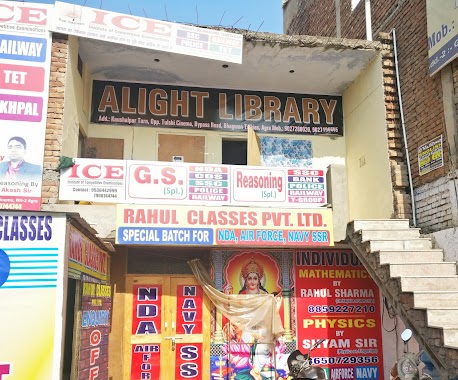
Alight Library
Opposite tulsi cinema,bhagwan talkies
Library
read more
6.51 km
People's Libreria
A80, new, Inder Puri, Agra
Library
read more
10.351 km
Jawahar Library
Laramda
Library
read more
📑
all categories
Accounting
Administrative area level 1
Administrative area level 2
Airport
Amusement park
Aquarium
Art gallery
Atm
Bakery
Bank
Bar
Beauty salon
Bicycle store
Book store
Bowling alley
Bus station
Cafe
Campground
Car dealer
Car rental
Car repair
Car wash
Casino
Cemetery
Church
City hall
Clothing store
Colloquial area
Convenience store
Courthouse
Dentist
Department store
Doctor
Electrician
Electronics store
Embassy
Finance
Fire station
Florist
Food
Funeral home
Furniture store
Gas station
General contractor
Grocery or supermarket
Gym
Hair care
Hardware store
Health
Hindu Temple
Home goods store
Hospital
Insurance agency
Intersection
Jewelry store
Laundry
Lawyer
Library
Light rail station
Liquor store
Local government office
Locality
Locksmith
Lodging
Meal delivery
Meal takeaway
Mosque
Movie rental
Movie theater
Moving company
Museum
Natural feature
Neighborhood
Night club
Painter
Park
Parking
Pet store
Pharmacy
Physiotherapist
Place of worship
Plumber
Point of interest
Police
Political
Post office
Premise
Real estate agency
Restaurant
Roofing contractor
Route
Rv park, camping
School
Shoe store
Shopping mall
Spa
Stadium
Storage
Store
Subpremise
Subway station
Supermarket
Synagogue
Taxi stand
Train station
Transit station
Travel agency
University
Veterinary care
Zoo
administrative area level 3
sublocality level 1
sublocality level 2
sublocality level 3
↑