Restaurant nearby Kathi Junction
India
Restaurant nearby Kathi Junction
Kathi Junction
SHOP NO. 63, OPP. DAINIK BHASKAR, PUDA Complex, Rajinder Nagar, Jalandhar India
contacts phone
:
+91
Latitude:
31.320186
, Longitude:
75.59561
read more
nearest Restaurant
253 m
Krishna Telecom & Tea Stall
Ladowali Road, Master Tara Singh Nagar, Jalandhar
Restaurant
read more
376 m
Tehsil Complex Canteen
Master Tara Singh Nagar, Jalandhar
Restaurant
read more
702 m
Hari Da Dhaba
Jalandhar City (Pb.)Near Resident Hotel, Near New Court Chowk, Police Line, Jalandhar
Restaurant
read more
770 m
Kala Chhole Bhature
Central Town, Jalandhar
Restaurant
read more
854 m
OM VAISHNI DHABHA
NEAR HAVELI,KHAJURLA,GT ROAD,, Jalandhar
Restaurant
read more
854 m
Family Point
Near Tagore Hospital,, Jalandhar
Restaurant
read more
854 m
Bhardwaj Fast Food
Cental Twon, Near Gurudwara, Opp. Mobile Market, Jalandhar
Restaurant
read more
916 m
Eat The Best
Madan Flour Mill Chowk, Nehru Garden Road, Jalandhar
Restaurant
read more
939 m
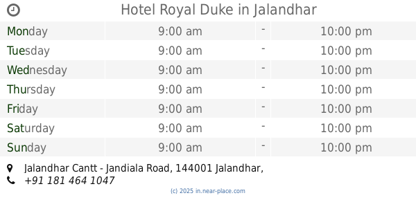
Hotel Royal Duke
Jalandhar Cantt - Jandiala Road, BMC Chowk,Near Sanjay Gandhi Market, Civil Line, Jalandhar
Restaurant
read more
960 m
Hotel Surendra Plaza
Garha Road, Opp. Bus Stand, Jawahar Nagar, Jalandhar
Restaurant
read more
969 m
RK Fastfood
118, Chogiti Bashir Pura Road, Kamal Vihar, Bashirpura, Jalandhar
Restaurant
read more
1.033 km
Raju Vaishnu Dhaba
Shop No. 182, Garha Road, Near Bus Stand, Mota Singh Nagar, Jalandhar
Restaurant
read more
1.221 km
Bholu Cook And Caterers
Street Number 8, Adjoining Geeta Mandir, Central Town, Jalandhar
Restaurant
read more
1.226 km
popeyes food
BSF Chowk, Mohyal Nagar, Jalandhar
Restaurant
read more
1.361 km
Chhani Dhaba
Ladowali Road, PAP Complex, Jalandhar
Restaurant
read more
📑
all categories
Accounting
Administrative area level 1
Administrative area level 2
Airport
Amusement park
Aquarium
Art gallery
Atm
Bakery
Bank
Bar
Beauty salon
Bicycle store
Book store
Bowling alley
Bus station
Cafe
Campground
Car dealer
Car rental
Car repair
Car wash
Casino
Cemetery
Church
City hall
Clothing store
Colloquial area
Convenience store
Courthouse
Dentist
Department store
Doctor
Electrician
Electronics store
Embassy
Finance
Fire station
Florist
Food
Funeral home
Furniture store
Gas station
General contractor
Grocery or supermarket
Gym
Hair care
Hardware store
Health
Hindu Temple
Home goods store
Hospital
Insurance agency
Intersection
Jewelry store
Laundry
Lawyer
Library
Light rail station
Liquor store
Local government office
Locality
Locksmith
Lodging
Meal delivery
Meal takeaway
Mosque
Movie rental
Movie theater
Moving company
Museum
Natural feature
Neighborhood
Night club
Painter
Park
Parking
Pet store
Pharmacy
Physiotherapist
Place of worship
Plumber
Point of interest
Police
Political
Post office
Premise
Real estate agency
Restaurant
Roofing contractor
Route
Rv park, camping
School
Shoe store
Shopping mall
Spa
Stadium
Storage
Store
Subpremise
Subway station
Supermarket
Synagogue
Taxi stand
Train station
Transit station
Travel agency
University
Veterinary care
Zoo
administrative area level 3
sublocality level 1
sublocality level 2
sublocality level 3
↑