Store nearby Khan Fabrication
India
Store nearby Khan Fabrication
Khan Fabrication
Mahal Gaon Gali No 1, City Center, Mahalgaon, Gwalior India
contacts phone
:
+91
Latitude:
26.199735
, Longitude:
78.188987
read more
nearest Store
79 m
Shiraj Electricals
City Center, Pathan Market, Near By Water Tank, Mahalgaon, Gwalior
Store
read more
257 m
Kela Devi Kirana
Shardha Bihar, Mahalgaon, Gwalior
Store
read more
451 m
Govardhan Dairy
Near SBI ATM, Pant Nagar Colony, Gwalior
Store
read more
510 m
Sanchi Milk Parlour
Jiwaji University, Mahalgaon, Gwalior
Store
read more
575 m
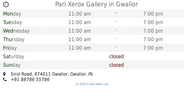
Pari Xerox Gallery
Opp. Hanuman Mandir, Sirol Road, City Center, Gwalior
Store
read more
645 m
Goyal Kirana
New Collectorate Road, City Center, Madhuwan Enclave, Alkapuri, Gwalior
Store
read more
676 m
Ghanshyam Tapra
City Center, Madhuwan Enclave, Alkapuri, Gwalior
Store
read more
709 m
Rolex Square
Bhaskar Lane, City Center, Gwalior
Store
read more
723 m
Friends Stationery & PhotoCopy
New Collectorate Road, City Center, Alkapuri, Gwalior
Store
read more
723 m
Pikuji Food Fun-Tastic ( resturant,cafe,coffee shop,vegetarian restaurant in Gwalior )
4,5 City Center, White House, Gwalior
Store
read more
831 m
Shree Gunish Photo Copy & Stationery
Shiva Arcade, Kailash Vihar, Near Income Tax Office, City Center, Gwalior
Store
read more
857 m
Thunder Zone PS4 Gaming Zone
40, Kailash Vihar Main Road, City Center, Tulsi Vihar Colony, Gwalior
Store
read more
928 m
Tripathi Stationery And General Store
Near By Bajrang Plaza, City Center, Tulsi Vihar Colony, Gwalior
Store
read more
1.049 km
Speed Photo Copy
Infront Of Water Tank, Sirol Road, City Center, Gwalior
Store
read more
1.293 km
TractorGyan.com
150-B, Govindpuri, Saraswati Nagar, Gwalior
Store
read more
📑
all categories
Accounting
Administrative area level 1
Administrative area level 2
Airport
Amusement park
Aquarium
Art gallery
Atm
Bakery
Bank
Bar
Beauty salon
Bicycle store
Book store
Bowling alley
Bus station
Cafe
Campground
Car dealer
Car rental
Car repair
Car wash
Casino
Cemetery
Church
City hall
Clothing store
Colloquial area
Convenience store
Courthouse
Dentist
Department store
Doctor
Electrician
Electronics store
Embassy
Finance
Fire station
Florist
Food
Funeral home
Furniture store
Gas station
General contractor
Grocery or supermarket
Gym
Hair care
Hardware store
Health
Hindu Temple
Home goods store
Hospital
Insurance agency
Intersection
Jewelry store
Laundry
Lawyer
Library
Light rail station
Liquor store
Local government office
Locality
Locksmith
Lodging
Meal delivery
Meal takeaway
Mosque
Movie rental
Movie theater
Moving company
Museum
Natural feature
Neighborhood
Night club
Painter
Park
Parking
Pet store
Pharmacy
Physiotherapist
Place of worship
Plumber
Point of interest
Police
Political
Post office
Premise
Real estate agency
Restaurant
Roofing contractor
Route
Rv park, camping
School
Shoe store
Shopping mall
Spa
Stadium
Storage
Store
Subpremise
Subway station
Supermarket
Synagogue
Taxi stand
Train station
Transit station
Travel agency
University
Veterinary care
Zoo
administrative area level 3
sublocality level 1
sublocality level 2
sublocality level 3
↑