Bus station nearby BMP Health Bus Stop
India
Bus station nearby BMP Health Bus Stop
BMP Health Bus Stop
Pailwan M Krishnappa Road, Halsurpete, Nagarathpete, Bengaluru Indien
contacts phone
:
+91
Latitude:
12.9640986
, Longitude:
77.5840397
read more
nearest Bus station
123 m
Town Hall
JC Road, Kumbaragundi, Sampangi Rama Nagar, Bengaluru
Bus station
read more
440 m
Corporation (Towards Subbiah Circle)
India
Bus station
read more
442 m
Corporation
Kalinga Rao Road, Sampangi Rama Nagar, Bengaluru
Bus station
read more
558 m
Corporation (Towards Cauvery Bhavan)
India
Bus station
read more
577 m
Corporation (Towards KR Market)
India
Bus station
read more
583 m
Poornima Talkies
India
Bus station
read more
583 m
Lalbagh Road Bus Stop
Lal Bagh Main Road, Raja Ram Mohanroy Extension, Sudhama Nagar, Bengaluru
Bus station
read more
585 m
Poornima Talkies
Lal Bagh Road, Raja Ram Mohanroy Extension, Sudhama Nagar, Bengaluru
Bus station
read more
674 m
Subbaiah Circle Bus Stop
Lal Bagh Main Road, Sudhama Nagar, Bengaluru
Bus station
read more
697 m
KR Market
Silver Jubilee Park Road, Dodpete, Nagarathpete, Bengaluru
Bus station
read more
724 m
St Marthas Hospital
India
Bus station
read more
726 m
Corporation Bus Stand
Kasturba Road, Ambedkar Veedhi, Sampangi Rama Nagar, Bengaluru
Bus station
read more
745 m
St. Joseph High School
India
Bus station
read more
779 m
Subbaiah Circle
India
Bus station
read more
784 m
KR Market (Kalasipalya)
India
Bus station
read more
801 m
Banglore
India
Bus station
read more
810 m
KR Market
India
Bus station
read more
871 m
Corporation Bus Stop
Raja Ram Mohan Roy Road, Ashwath Nagar, Ambedkar Veedhi, Sampangi Rama Nagar, Bengaluru
Bus station
read more
919 m
Pallavi Talkies
India
Bus station
read more
990 m
Mysore Bank Bus Stop
District Office Road, Ambedkar Veedhi, Nagarathpete, Bengaluru
Bus station
read more
991 m
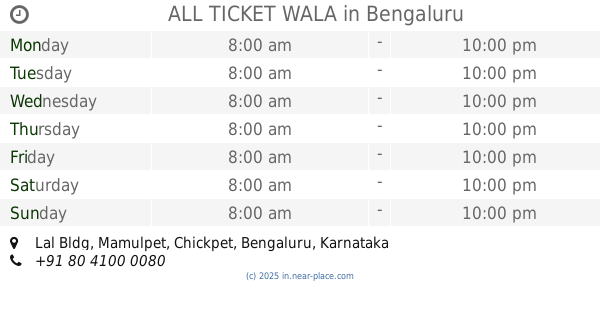
ALL TICKET WALA
Lal Bldg, Mamulpet, Chickpet, Bengaluru
Bus station
read more
995 m
KR Market
New Tharagupet, Bengaluru
Bus station
read more
1.1 km
Minerva Circle
India
Bus station
read more
1.177 km
Basappa Circle
Sajjan Rao Road, Parvathipuram, Vishweshwarapura, Shankarapura, Bengaluru
Bus station
read more
1.2 km
KH Road
Kengal Hanumanthaiah Road, Shanti Nagar, Bengaluru
Bus station
read more
📑
all categories
Accounting
Administrative area level 1
Administrative area level 2
Airport
Amusement park
Aquarium
Art gallery
Atm
Bakery
Bank
Bar
Beauty salon
Bicycle store
Book store
Bowling alley
Bus station
Cafe
Campground
Car dealer
Car rental
Car repair
Car wash
Casino
Cemetery
Church
City hall
Clothing store
Colloquial area
Convenience store
Courthouse
Dentist
Department store
Doctor
Electrician
Electronics store
Embassy
Finance
Fire station
Florist
Food
Funeral home
Furniture store
Gas station
General contractor
Grocery or supermarket
Gym
Hair care
Hardware store
Health
Hindu Temple
Home goods store
Hospital
Insurance agency
Intersection
Jewelry store
Laundry
Lawyer
Library
Light rail station
Liquor store
Local government office
Locality
Locksmith
Lodging
Meal delivery
Meal takeaway
Mosque
Movie rental
Movie theater
Moving company
Museum
Natural feature
Neighborhood
Night club
Painter
Park
Parking
Pet store
Pharmacy
Physiotherapist
Place of worship
Plumber
Point of interest
Police
Political
Post office
Premise
Real estate agency
Restaurant
Roofing contractor
Route
Rv park, camping
School
Shoe store
Shopping mall
Spa
Stadium
Storage
Store
Subpremise
Subway station
Supermarket
Synagogue
Taxi stand
Train station
Transit station
Travel agency
University
Veterinary care
Zoo
administrative area level 3
sublocality level 1
sublocality level 2
sublocality level 3
↑